Discover how GIS For Watershed leverages cutting-edge GIS and AI technology to transform watershed management and environmental monitoring. Learn about interactive tools for spatial analysis, hydrological data, and sustainable water resource planning. Join researchers and professionals using smarter solutions for a healthier watershed future.
Welcome to GIS For Watershed
Discover GIS For Watershed, your smart geospatial partner for watershed management and environmental monitoring. Harness advanced GIS and AI tools to visualize and analyze watershed systems efficiently. Join researchers and professionals in making informed, sustainable water resource decisions.
Our Services

Land Use and Cover Monitoring
Track changes in land use and vegetation cover to evaluate impacts on watershed health and water quality.

Terrain and Elevation Modeling
Generate 3D terrain models and conduct slope, aspect, and elevation analyses to understand watershed topography.

Environmental Risk Assessment
Identify and assess potential environmental risks including erosion, pollution sources, and habitat disruption within watersheds.
Gallery
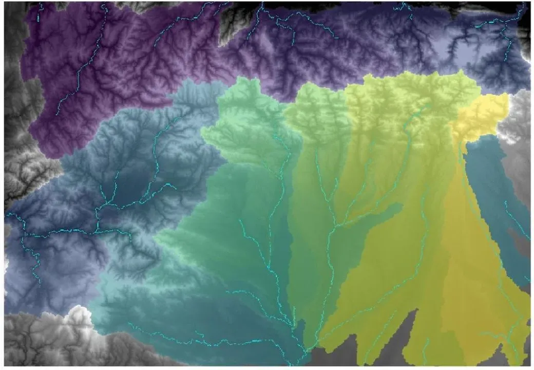
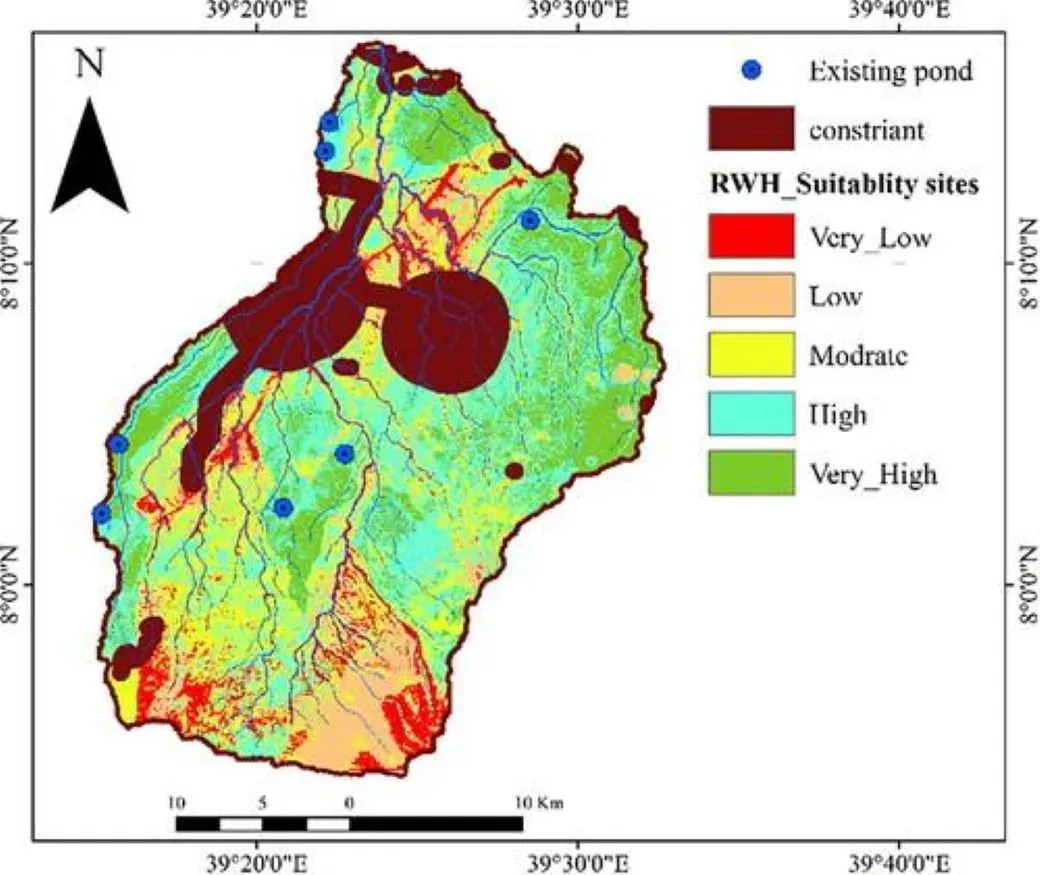


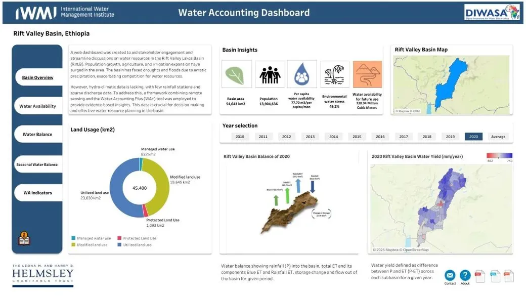
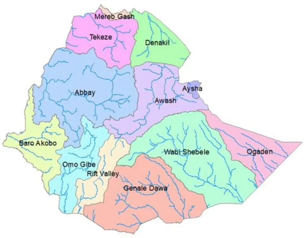
1 / 6
Empower Watersheds, Empower Life.
Explore smarter water solutions now!
Empower Watershed Management Today
Reviews
1 / 2