Real Time Sonar
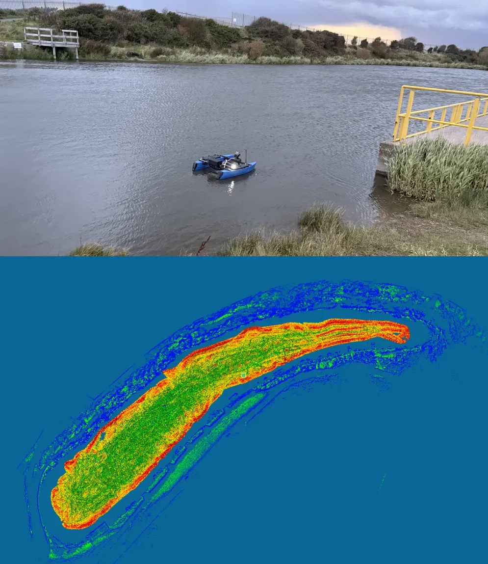
The real-time sonar (RTSonar) mapping system is a GPS-denied underwater survey solution developed for integration with Unmanned Surface Vehicles (USVs), but also available as a standalone sensor system for third party integration.
Designed specifically for nuclear decommissioning and confined-water environments, the system utilises multi beam sonar technology to produce continuous, geospatially referenced 3D models of the subsurface environment.
The RTSonar enables accurate mapping in indoor or enclosed ponds where conventional hydrographic methods fail. The software and hardware integration allow for live point cloud generation of both the above water and subsurface environments, precise vehicle pose estimation, and seamless data stitching, providing operators with high-resolution models of underwater structures and debris.
This technology enhances situational awareness, reduces survey time, and supports safe, remote characterisation of contaminated or complex aquatic environments within the nuclear and environmental monitoring sectors.
Specifications:
Bellow Water Mapping
- Sonar max depth: 350 m
- Operating frequency: 400 kHz (> 30 m) 700 kHz (< 30 m)
- Range resolution: < 8 mm
- Max range: 100 m @ 400 kHz / 30 m @ 700 kHz
- Min range: < 0.2 m
- Max update rate: 25 Hz
- FoV: 120° / 20° - 256 beams
- Angular resolution 1.5° - 0.47° beam separation
- Operational temp: 0 °C to +35 °C
- Construction Material: Titanium and Delrin
- RTSonar data output: .CSV point cloud- raw sonar returns file and highest intensity on swath file, as well as live output through ROS
Above Water Mapping
- Range: 40 m @ 10% reflectivity, 70 m @ 80% reflectivity
- Precision: < 20 mm @ 10 m, < 0.15°
- Wavelength: 905 nm / class 1 laser
- FoV: 360° pan / -7.52° tilt
- Operating temp: -20° C to +55° C
- Point rate: 200k points per second (first return)
- IP rating: IP67
- Max singular survey: 2 hours
- TF update rate: 15-100 Hz (default 50 Hz)
- Point cloud output: Live PointCloud2 output (ROS / Foxglove) and .pcd output
USV
- Endurance (1 m/s): 18 hours operational time (standard battery)
- Max speed: 3 m/s (6 kts)
- Steering type: Differential thrust
- Payload capacity: 15 Kg (including batteries, 13 Kg excluding)
- Payload power: 14.8 / 22.2 V nominal, 60 A (direct), 10 A (fused), 5 V, 5 A fused
- Interfaces: 10/100 Mbit Ethernet via built in switch, USB2.0, USB3.0
- Dimensions: 120 / 93 / 46 cm (deployed), 120 / 93 / 24 cm (stowed)
- Mass: 16 Kg
- Software: ArduRover / BlueOS (flight computer), Debian (payload computer)
- Mission planning software: QgroundControl / ROS
- Navigation: Manual (joystick), waypoint based / click to nav / position hold / RTS (GPS fix required), auto survey (MCRS GPS denied autonomy – user defines survey outline perimeter)
- Communications: Long range WiFi (~200 m) / Rajant mesh radio system (unlimited depending on mesh node deployment) / Cellular (unlimited) / Satellite (unlimited)